File:VANG SITE.jpg
Jump to navigation
Jump to search

No higher resolution available.
VANG_SITE.jpg (443 × 300 pixels, file size: 21 KB, MIME type: image/jpeg)
Summary
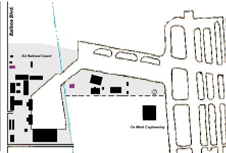
A map showing the location of the On Mark building. The main runway on the right shows the approach end of runway 16R (heading south, toward the bottom of the frame). Image credit Mark A. Reynosa.
File history
Click on a date/time to view the file as it appeared at that time.
| Date/Time | Thumbnail | Dimensions | User | Comment | |
|---|---|---|---|---|---|
| current | 05:23, 29 September 2020 | | 443 × 300 (21 KB) | WikiSysop (talk | contribs) | A map showing the location of the On Mark building. The main runway on the right shows the approach end of runway 16R (heading south, toward the bottom of the frame). Image credit unknown. |
You cannot overwrite this file.
File usage
The following page uses this file: